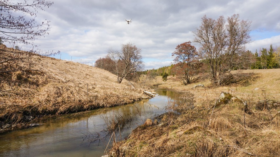
Water flow measurement with drone
Reliable water flow data is fundamental for drawing the right conclusions both in hydrological research and for society's water management. Traditional water flow measurement is based on empirical methods, so-called discharge curves, which describe the relationship between water level and water flow at a watercourse section.
Developing birth curves is both time-consuming and costly, and in many cases can lead to great data uncertainty. These data uncertainties can in turn be propagated to erroneous scientific conclusions and costly consequences for society.
The project's goal is to use drone technology together with hydraulic modeling of discharge curves to limit uncertainty in water flow data and thus develop a faster, safer and more cost-effective method for measuring water flows.
The water flow in a watercourse section is determined not only by the water level, but also by the physical properties of the watercourse and by the hydraulic condition. With the help of drones, you can map both the physical properties (topography, vegetation and flow resistance) and the hydraulic condition (slope of the water surface and the flow rate). In this way, the data needed to calculate discharge curves with hydraulic modeling can be produced quickly and easily.
In the project, we will evaluate how well the drone-based method works with the help of an uncertainty framework to test the drone-based method's potential to improve water flow data at different measuring sites.
Project facts
- Water flow measurement with drone
- Budget: 3 miljoner SEK
- Financed by: Formas
- Partners: IVL Svenska Miljöinstitutet and Stockholms university
- Period: 2020 - 2023
Contact
Want to know more about IVL's services and offers? Enter your email address and choose which area you want to know more about, and we will get back to you.
NOTE! For questions about vacancies and thesis work, go to the Careers
tab in the main menu.